 9.6 miles 4h 14min ascent 686m
Moorbrock Hill-Keoch Rig-Mid Hill of Glenhead-Dodd Hill
The walk starts at the entrance to Moorbrock Estate about a third of a mile beyond Craigengillan bridge. The gates were locked but there was plenty of space to park without obstructing the entrance. We had a few spots of rain on the windscreen as we approached the start, but that was the only rain we had all day.
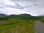
The estate road slowly climbed, through the forest, past many erratics, over a spur from Dodd Hill. As we left the trees the road began to dip down towards a small bridge over the Polifferie Burn and we had our first view of Moorbrock Hill and Benniner beyond it. The track we were on, standing out a bright white against the green surroundings could be seen winding up to Moorbrock Farm and then onto the hill itself. At this point we passed the junction with the track we were to return on later in the day. It is not on the OS map so confirmation of its existence was welcome at this stage.
The Polifferie Burn (poll a’ foithre, the stream in the woods) appears from the tree covered valley that we were to walk around, and joins the Water o’ Ken at Craigengillan. Close to Moorbrock Farm are a series of terraced ponds which must have some purpose but I don’t know it. The farm buildings were very neat and clean, looking much more like a holiday home than a working farm but it is a bit isolated for a holiday, and Conor wondered if it might be useful for a witness protection program. There was no sign of life and I was tempted to glance into the window of a building as we passed, but decided that would be rude.
The track diverges at the farm, one route heading north up the valley and the other, which we took, climbing northwest beside the Poltie Burn (poll tighe, stream of the house) onto Green Hill. The gradient here picks up enough to require shedding of layers.
Here I had my first experience of Jelly babies clubbing together. The packet had been stored in the boot of the car and I had tossed it to Conor as we set off. As we paused to divest and have a drink he opened the packet. The JBs had fused into a single mass which proved surprisingly difficult to rip apart. At least we didn’t have any of that bother about choosing particular colours, each lump torn from the mass was multi-coloured. It does say on the packet “Store in a cool dry place.”
About half a mile after the farm the track takes a sharp turn to the left to slowly climb around Green Hill, but we chose to head straight up the beside the Poltie Burn. This is a bit steeper but saves about two thirds of a mile. The way up beside the burn is amongst tussocks at first but becomes easier as height is gained. Looking back during brief pauses for breath we could see Criffel on the horizon. We rejoined the track at about 590 metres, and the going was easier after that.
The summit of Moorbrock Hill is not marked, though it is reasonably obvious where it is. Once on the top the views certainly opened up. To our left was Beninner and Cairnsmore of Carsphairn. The gairies of each don’t look inviting to walkers but there are walkable spurs at either end of these hills. I had been tempted to turn that way but decided to stick with the plan. Ahead of us was Windy Standard and the Afton Hills. To our right, Dodd Hill with a lochan at its top.
Moorbrock has a secondary summit at its northern end and this was marked by a small cairn. Perhaps cairn is an exaggeration for what is really just a small pile of stones. Walkers should be asked to carry some stones up to make this more presentable. From Moorbrock we headed down, out of the wind, to the col between Moorbrock and Keoch Rig, a sheltered spot, with rocks to sit on while having a bite to eat.
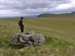
Once on Keoch Rig there were views down three glens, Clennoch, Polifferie, and Holm/Dalquairn. I decided to visit the Deil’s putting stone, an erratic with a bowl shaped hole worn in the top, since it’s marked on the map. Unfortunately it was not particularly exciting.
From the stone it’s only half a mile to the top of Windy Standard, but we turned away towards Mid Hill of Glenhead. The col before this is marked as the Hags of Poljargen (pol deargdn, the red stream). There are no peat hags here now but the soil does have a red tinge. Throughout this walk we were on dry terrain but I am sure, judging by the vegetation, it is usually wet.
Climbing Mid Hill we also came close to a fox, perhaps just 15m away and once on the summit we could see the Striding Arch on Benbrack and the Radar station on Lowther.
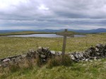
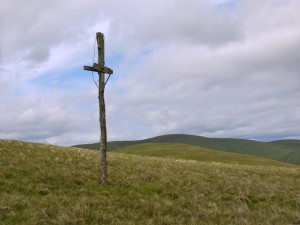
I had wondered as we walked if the crosses I had heard about on Dodd Hill would still be there, and in the col between Dodd and Mid Hill we found a large cross lying on the ground, but as we climbed we saw some others at the top.
The crosses are marked with roman numerals and represent stations of the cross. Including the cross lying in the col we found four. I did not see any further down the hill.
Dodd Hill’s other unusual feature is the lochan at its summit.
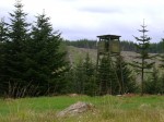
From Dodd Hill we headed down just west of south to join a track. This is another tussocky section that I suspect can be wet at times, but once on the track it was a straightforward walk back to the car and we were able to sneak past the sentry post without any trouble.

