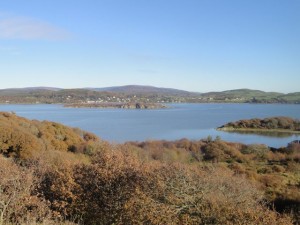
Mike’s evil twin, the one who takes over his body and mind when choosing routes, surpassed himself with this easy, flat stroll in the solway riviera.
A short walk, on OS paths, so no need to take the map. We left the car in Palnackie, which is world famous for its flounder tramping, and headed south on the west side of Urr Water past the North Glen Glassworks. The road then passes through Tornat Woods and we left the the main track to head over fields. The height gave good views of Glen Isle, Rockcliffe and Rough Island.
Unfortunately the path petered out and we crossed a stile to climb a little higher and having negotiated an electric fence followed some vehicle tracks. I had thought that we had strayed off the path but looking at the aerial photos in bing maps we were actually very close to the true route.
The vehicle tracks led us, through slightly boggy ground to the upper corner of a field with a drystone wall and electric fence. The fence had a stile next to steps in the wall. Although the nearby shrubs and trees had almost overgrown the area it seemed the most obvious way to go. The actual route was out from the bottom corner of the same field.
Our new route allowed us to practice our quagmire crossing skills, something you don’t get to do on namby-pamby paths. We’ll all laugh about this one day, I’m sure.
So eventually we were back on a track, having reached the road to Almorness House just a little south of Orchardton Tower. The path has some rather imposing gateposts and a new looking drystone wall.
From Almorness House there were several paths to choose from. One was clearly the path we should have arrived on, another the path we would expect to return along. That left two more. One heads down towards Rough Firth and we took the less defined track leaving the first via a farm gate. This is indeed the correct way.
We came to a fork in the path and took the right hand fork which climbed to higher ground. Though this eventually led us back to the path is was only after fighting our way through a dense bramble patch because the path was flooded. The first time in D&G that I have felt the need for a machete. I bet Jo would have had one in her rucksack.
A bit of a diversion but we were back on the real path…for a while. The next diversion came near to a pheasant coup. We had climbed a small promontory, marked as “52” on the OS and could see across to another small hill which is the Moyl, the hill at the end of the peninsula.
Having returned to the coup we headed off along a faint track and in so doing left the real track, though for the life of me I couldn’t see it. The new path headed south, rather than south east. Instead of leading us to the beach of Horse Isles Bay we were about 250m west of it in an area marked as “Merse” and characterised by tussocks, mud, standing water and eventually a small lochan spilling out across our path.
Following an unsuccessful attempt to head west…more water, time was called. I hadn’t got the part of the message about the need to be back by 2pm and was therefore unaware of the growing frustration with our lack of progress. So back through the quagmire it was.
We were about 350m from Almorness Point, when we turned back but I’m not sure the way was passable where we were.
The walk back took us past Orchardton Tower. This was built in about 1456. There appears to be a shed on its roof, but googling reveals this to be a gabled caphouse covering the stairwell.
Refreshments were taken at the Glenisle Inn.
Though, obviously, we will need to lick our wounds and recover psychologically from this trek, one day we must return, perhaps in wellies and with machetes in hand.
PS Some information on Beeswing


