
5.1 miles 2h 34m ascent 336m
Queensberry from Mabie
Route: Mabie Forest, around Marthrown Hill on MTB tracks then up and over in the trees
Feeling a little under the weather I decided to ditch the planned walk (which included an FFS section) and instead just mosey around Mabie with the dogs. I thought I might perhaps visit the top of Marthrown Hill. The OS map has a fire tower near the top, so I thought there must be a way for people to get to the tower relatively easily. That was my mistake. On reflection, nursing my bruises, I realise now that it actually means there must have once been an easy way.
Various paths run around Marthrown Hill so I got myself on the highest one I could find then set off clockwise looking for a likely way up the hill. Much of the path has young trees densely planted beside it, so on and on I walked.
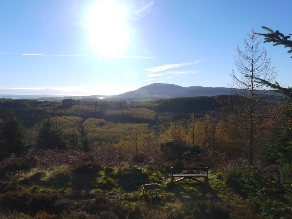
There is a viewing point with a bench at about NX936738 with nice views over to Criffel and the Solway. This was actually the highest point on the track. Behind this I noticed a faint track up into the trees. Within 10m however, the trees were too dense to pass, so I returned to the path and continued on around the hill.
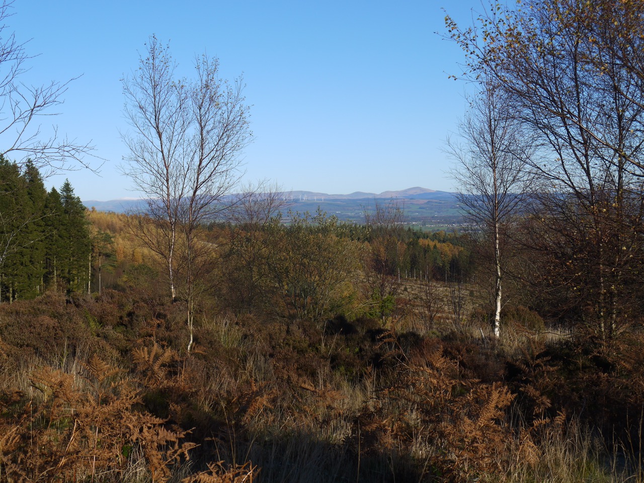
Criffel from Mabie
The path from the bench is part of the official walking routes and carried me onto a forestry road with orange way marker posts. The lochans here were frozen over so I rushed past before Sweep noticed and jumped in. He had already fallen foul of frozen puddles in the ditches but that was just wet paws.
I stayed with this route for a little while but left the orange route to stay on a higher path.
Eventually I began to experience deja vu, and realised that I had done an entire round of the hill without finding a way up. Since there was no obvious route I would just need to find a way through the trees so I left the path and headed directly up at a section of forest that looked relatively passable. This was somewhere around NX939709.
This was steep but the trees were tall without low branches and the undergrowth was sparse. At first.
Eventually the trees became younger and more densely packed. Where there were gaps in the trees they were filled with felled or fallen tree trunks with dense bracken overlying hidden ditches.
The higher we went the closer the trees became and the terrain more difficult. Leo could not get over some of the obstructions and had to be lifted while Sweep forged on a ahead, his position shown by movement of the undergrowth or the noise of him flopping into a ditch.
Having struggled across some particularly difficult ground to a slight rise we had reached a point where I could see a likely candidate area for the summit, a stand of trees a little higher than where I stood, but the terrain separating it from me would have been impossible for a small, elderly, terrier. Time to bail out. The GPS tracker shows I was probably within 100m of, and just 13m below, the summit.
I thought the previous 100m had been too difficult for the wee dog to go back that way. There seemed to be an easier way almost directly north and the closest path was that way. Seemed is the operative word here. The grass always looks greener etc.
This proved to be a rather unpleasant descent. 400m of horizontal distance, downhill, took almost half an hour. I was plagued with mirages where I thought I glimpsed a break in the trees only to find that it didn’t exist. The trees with intertwined branches were too close to pass between at times and fallen trunks blocked other ways through.
I caught my foot in a root just above a 1m step and experienced acceleration at 9.8m/s/s followed by a rapid mud-induced deceleration. Wet, muddy, and covered in pine needles I lay there looking up at one dog while the other barked at me. I thanked my lucky stars that nothing was broken, bones or equipment.
Leo looked down at me, unable to see how he would get down (answer: by manhandling him). Sweep, always unhappy when I stop on a walk, continued barking at me until I had disentangled myself and was on the move again. The terrier had to be manhandled in several other sections as well as the step I had fallen over, but give the old dogs their due, they kept going.
When I could at last see the MTB track, my way to it was again blocked by young trees growing amongst fallen older trees so a further diversion through the forest was needed to find a way onto the path.
I sighed with relief on escaping the trees. If I’d had a flask of whisky, that would have been the time to take a slug. Instead I picked the pine needles from my hands, brushed the mud from my camera and took the shortest route back to the car park.
I will no doubt have to return to Marthrown Hill and climb those additional 13m and it will be all the more exciting having failed this time. So much for a stroll around Mabie.
