9.8 miles 4h 45m 680m ascent
The remotest hill in Galloway? I’d been longing to climb Mullwharchar for a while, but the routes were off-putting. I didn’t fancy tramping up the Gairland Burn when it had been raining all week and was concerned about the burn crossings if we went from Backhill. The alternative was to walk in from the north.
The outing started with a drive down the west shore of the lovely Loch Doon, past the rebuilt castle ruin and down to the waterfalls of Carrick Lane. I must say that the “waterfall” marked on the OS is a bit of a let down, but perhaps it comes into its own when the stream is in spate.
I had been worried that we would be walking from the car-park at the waterfall but the gate across the forest drive was open so we were able to drive down across the bridge over Whitespout Lane, saving ourselves 3.5 miles of walking.
The weather forecast was for rain later in the day, with varying times offered by each service. The sky was overcast so we feared the worse. What I didn’t expect was to get sunburnt. That’s Galloway for you, cold, wet and sunburnt.
We took a forest track heading off east and then turning south, which looked as if it could have taken a car, but knowing my luck it would have sunk while we were walking.
At the second firebreak we turned left and had our first taste of waterlogged ground. Fallen trees blocked the way twice but at the first some kindly person had sawn off the tree to allow trekkers to pass. (No, not trekkies). The second pair of fallen trees required clambering and had a dangerous short branch sticking up to catch the unwary with short legs.
The forest break then had a brief downhill section, something I dislike on the outward walk since it means uphill on the way back. But down at the bottom of the path was a bridge crossing Eglin Lane. Given our previous experience with ghost bridges this produced a sigh of relief. Eglin Lane certainly didn’t look amenable to a dry crossing without a bridge. From the bridge we could see The Merrick (Tiu Meurach), but Mullwharchar was hidden behind Hoodens Hill.
Ahead of us was a wee hill, Craigmawhannal but we turned south towards the ridge running down from Hoodens Hill and set off across squelchy grassland following an animal track. The younger members of the group fired on ahead and led us to higher ground. This was no drier and therefore entailed extra effort without gain. Ah, the youth of today, they just don’t have the laziness we have.
I think it was along here that James had his first slip, though he saved his full blown fall for later. This section was a bit of a slog and fleeces were soon packed away. Indeed there was a chilly moment when James took off his top revealing himself to be wearing Conor’s “lost” t-shirt.
There are granite slabs scattered over the higher ground and we were able to use these as pavements or stepping stones as we climbed the ridge to Gordon’s Loup and Hoodens hill. As we got higher the wind began to pick up, as it does.
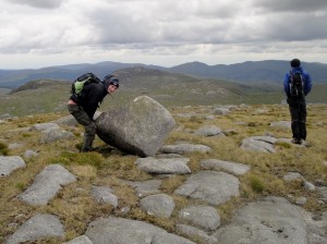
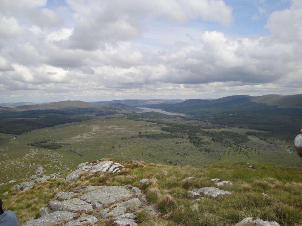
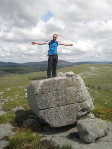
The climb up Hoodens ridge is full of false summits to sap the morale of the unwary but as we climbed the views improved. Certainly by the time we were at Gordon’s Loup at just above 400m we could see the cliffs of the Wolf Slock (the pictures don’t do them justice), the Rhinns of Kells, the Awfu’ hand, and the lochs Doon, Macaterick and Riecawr. There were scattered erratics balancing on smaller rocks allowing some candid photos.
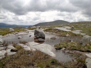
Hoodens Hill has several prominences all of which have cairns of one size or another. We had some photos with the largest cairn but I suspect it was not the highest. There were several lochans up here, one with an erratic poised artfully in its centre.
Looking down to the col between Hoodens and Mullwharchar it didn’t seem too bad a challenge. Obviously the drop down from Hoodens is small enough to demote it to a mere shoulder of Mullwharchar, but there is 200m of climb up Mullwharchar picking between tussocks and stones. The feral Goats kept their distance (spotted by Andy, since I am blind to goats unless they are pointed out).
From Loch Enoch, Mullwharchar looks conical but from the north it presents a kilometre long ridge with some uncertainty as to which end has the summit. It is the SW end. We stopped just below the true summit of Mullwharchar to hide from the wind while having lunch. The temperature seemed to drop but perhaps that was in part because we had stopped walking. I certainly felt better with hat and coat added to the outside and sandwich and pie on the inside.
The summit has a cairn but the hill is surprisingly flat on top despite its appearance from Loch Enoch. I wandered down to the south to have a better look at Loch Enoch and the Dungeon Hills. I had thought of continuing on to Dungeon Hill, but it seemed right to leave it for another day and another approach. It was interesting to compare the green colours of the hills today with the golden browns of our outing to Merrick in September.
I had thought of making this a circular walk back over Macaterick but was worried we would have difficulty with the burn crossings so we headed back the way we had come.
The descent of Mullwharchar was easier than ascent but we now had problems slipping on the wet grass and underlying mud. Much “ooh”ing and sudden flailing of arms was done.
Contouring around Hoodens hill didn’t seem possible given its steep sides in places so we headed back up to the top. Eagle-eyed Andy spotted a frog on the way up Hoodens but later blew his chance of usurping Attenborough by pointing out a “thingy” then clarifying it was a “bird” before identifying it as a wagtail.
The ridge this time seemed to have many more prominences. I counted five, and four of those are evident on the GPS track. As I looked east to the Rhinns of Kells I thought that this ridge was a miniature version of those rhinns.
Once at the bottom of the ridge, where granite and moist earth gave way to tussocks and waterlogged ground we headed for the Wolf Rock, which is a boulder that looks as if it has been sliced by a giant with a magic knife.
We had a breather at the Eglin Lane bridge then headed up the fire break. This seemed steeper that it had four hours earlier but, as my memory failed me, I thought the forest track was just ahead. Then we reached the fallen trees and I remembered the break was somewhat longer.
Once on the forest track we were out of the Galloway bogfest and could stride along happily without worrying where each foot would go.
We took coffee at the Doon Castle tearooms, in nice big mugs then I went to be tormented by cars while trying, unsuccessfully, to get a reasonable photo of the castle. The forecast rain began to fall as we sipped our drinks. What timing!


