
4.8 miles 3h 30m ascent 366m
 Route: Wee Hill of Craigmullach-Craiglee-Mulluss
The Range of hills called the Awful Hand can be seen, by those of elastic imagination, as a hand reaching onto the land from the depths of the earth. When seen from the west, the summits look like knuckles and their western ridges fingers. The size of this fist would suggest it belonged to a giant standing 115 km tall. Upright its head would be in outer space, but perhaps these giants lay flat on the ground, nestling in valleys, grinding, eroding and moving rocks at what we would regard as a glacial pace?
When these ancient giants were shaping the mountains, valleys and lochs of Galloway, they set aside some of the smaller building materials and no doubt looked on proudly as a child giant, imitating her parents, began to build some small hills of her own. The craggy hard stones she used to make Craiglee, some left over hummocky moraine was piled up into the Wee Hill of Craigmulloch and the remaining parts, mainly craggy knolls, were swept into a small uneven pile, Mulluss.
Watching her parents as they added the finishing touches to their hills, the child giant decorated her work as they did, adding a bog in the col between the main hills, not forgetting to include some streams to drain excess water, and a small lochan just below the summit to hold the blue of the sky. Finally as she left, and just before washing her hands in the clear waters of the new Loch Doon, she cast handfuls of granite erratics over her work, the pattern of the erratics spelling her name. This was the giant’s way of hallmarking their work and she had seen her parent’s doing just the same.
Though the giants left these hills long ago, that child left something more than her wee hills behind. She also left an urge to build. This enchantment grips some of those who visit her hills and conveys a pervading urge to build. Even the mosses, grasses and heather that have covered the land have built a layer of soil, though they have left the erratics, a few crags and the lochan uncovered for now so the builder’s name is not lost. When other wanderers reached these places they too were driven by this urge to build and they have left cairns, mountains in miniature not yet conquered by the soil makers, at the summits and promontories, even on lowly Mullus. On Craiglee, a pillar fashioned from aggregate and cement, has been erected at the highest point by the last century’s cartographers. The giant would have found it a bit of an eyesore, I should think, but there’s no accounting for taste. Arcane lettering can still be seen on it, but the elements have taken their toll and it can no longer be read.
Well, surprisingly enough, that’s the story that came to mind as I looked at these hills.
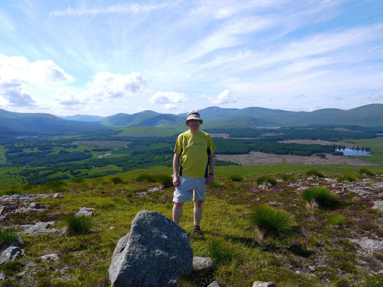
It was a warm sunny day but with heavy rain forecast for later so I plumped for a relatively early start even though it was only a short walk. I was keen to do this walk in good visibility because I wanted to get the most out of the views and I struck lucky this time. The drive along Loch Doon was surprisingly pot-hole free and there were only a few sheep on the road. The surroundings were very easy on the eyes and the loch was low enough to reveal the old castle island. The car park near the castle has a boulder that is just the right height to sit on for putting on boots, and more comfortable than the boot of the car.
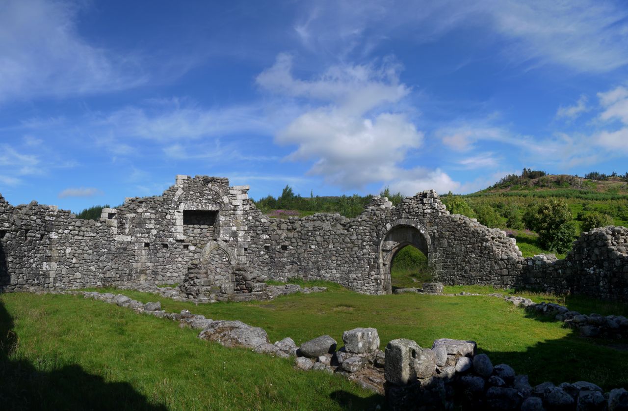
Loch Doon Castle
Though I’ve driven past Loch Doon Castle many times and even walked up to the outer wall, for some reason I always seem to go there at the end of walks when I’ve used up my enthusiasm so this time I started by exploring the castle. It’s quite strange to think that these ruins were rebuilt here only 80 years ago when the loch’s level was raised 27 feet by the hydroelectric system. Mind you I’m more impressed by the the initial construction. It must have been quite un undertaking to build a castle like that out on an island in the loch. Over on the far side of Loch Doon there are some unusual structures crossing the burns. I had first noticed these when making my way off Coran of Portmark in April last year. They look like rail bridges but I had not been able to work out why they were there. Now I know. They were part of a WW1 rail mounted gunnery target range for aircraft. That will be why there is a modern looking brick building near the older ruins of Portmark. The project was not a success, apparently.
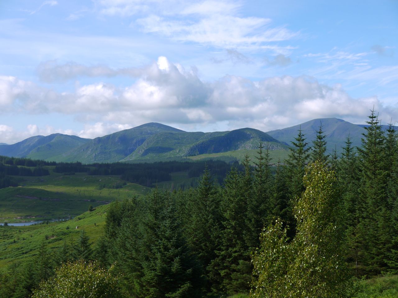
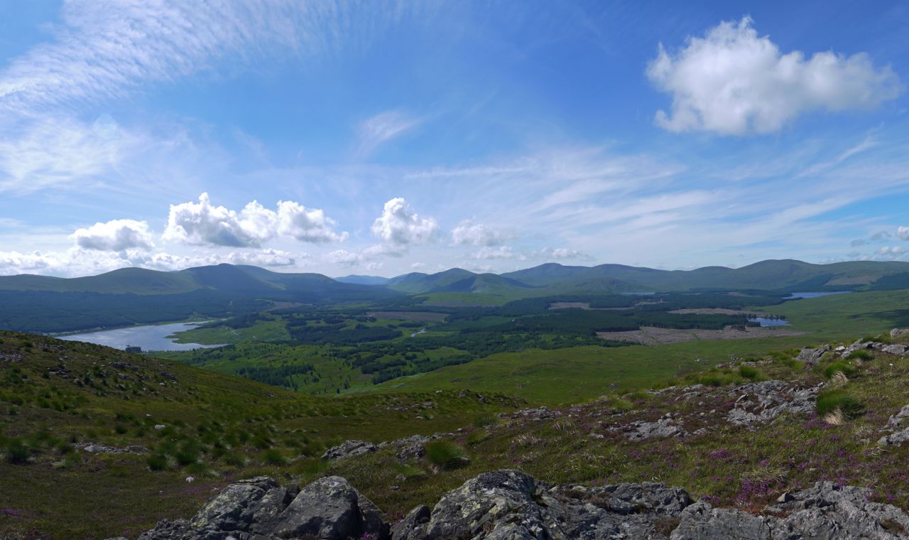
After absorbing the ambience of the castle ruins, in sunshine and under blue skies, I headed off the the start of the Craiglea trail, marked by a large post. The trail is about a hands breadth wide and starts on firm mown grass between ferns that were taller than me. Soon enough though the path climbed and within just a few minutes gave fantastic views of the Galloway Hills, right across from the Rhinns of Kells to the Awful Hand, Mullwharchar taking centre stage. The green of the intervening land was so rich that if I had seen it on a photograph I would have thought the photo had been enhanced in photoshop. Though the views were more extensive from the summits they didn’t beat the views from the lower slopes of Wee Hill of Craigmulloch (hereafter called the Wee Hill).
Galloway Hills from the Craiglea Trail
On the trail there were swarms of (well, quite a few) black and red butterflies, Scotch Argus, I think, and a magnificent golden-ringed dragonfly followed me for a few minutes then stopped on a rock for her photo. The Trail passes through the remains of a sheepfold, and here the dragonfly chose to let me go on alone. The path then became less well defined. I take it fewer people walk on beyond the sheepfold so the path has become more overgrown. A little way further on a faint path towards the Wee Hill leaves the trail. It is as though the trail reaches a T junction and I turned right. There were a couple of posts there that look as though they once held a sign.
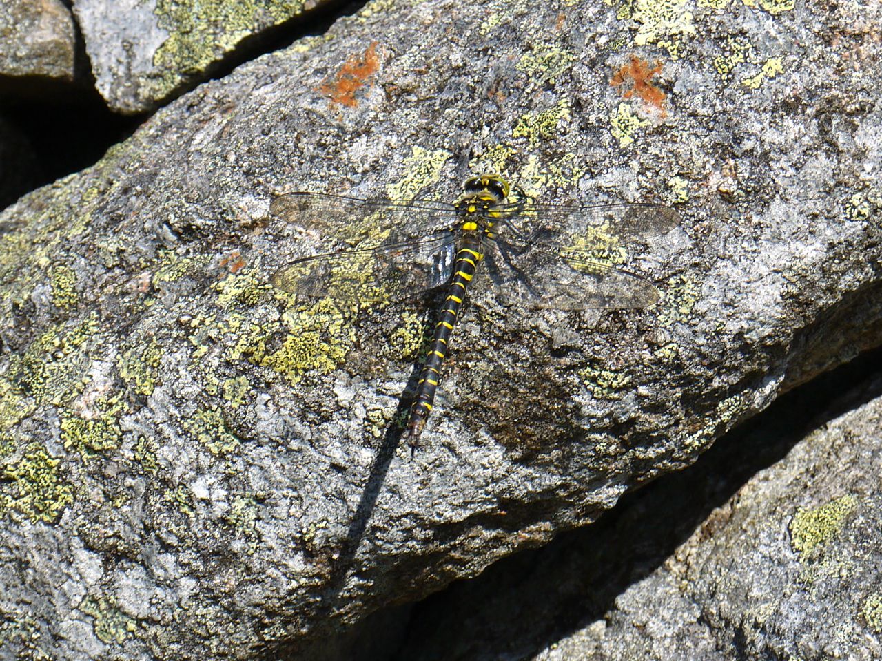
Golden Ringed Dragonfly
The track onto Wee Hill became fainter until I began to think that it only existed in my mind. Every now and then, though, especially on steeper sections the ground had been pressed into steps by walkers on mushier days. There are a couple of flattish shelves on the way up the hill and these sport the characteristic “I am wet” type vegetation, but I had chosen a dry day so it was like walking across a mattress. The flowers were putting on a spectacular show, the bright purple of the bell heather and pink of the ling contrasting with extensive bright yellow patches of bog asphodel. The cotton grass was past its best but a few white patches still remained.
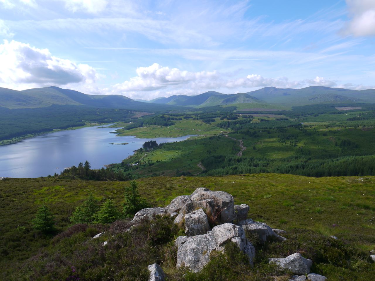
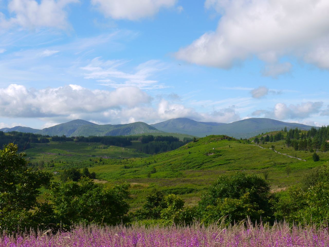
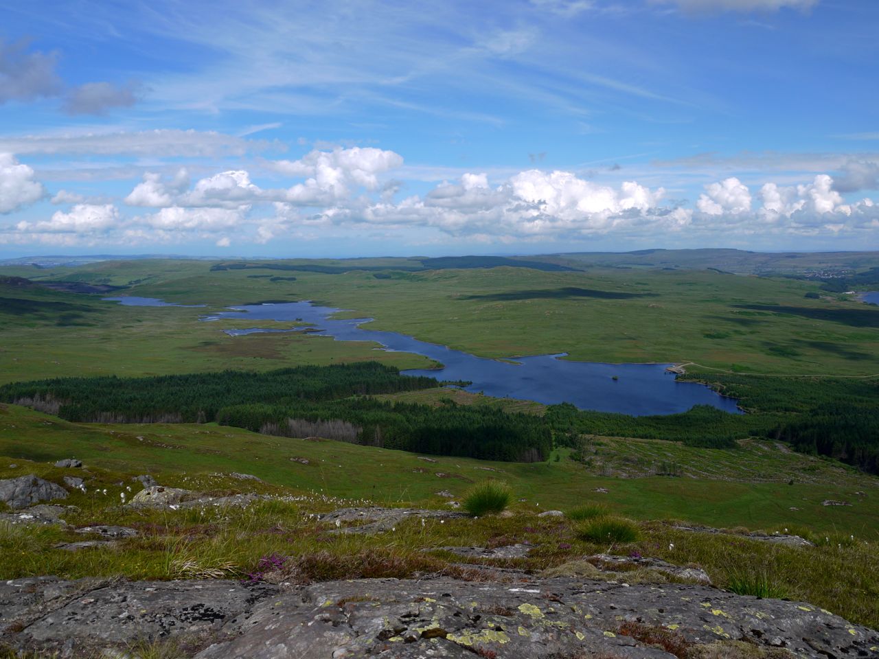
View south from the Wee Hill of Craigmulloch
Reaching the top of Wee Hill allowed me to see the full 10km of Loch Doon, and see over the end of the Rhinns of Kells to the Carsphairn Hills. To the south the hills beyond Loch Dee 20km away were just visible. At this stage Craiglee looked to be a predominantly green conical hill, calling into question the interpretation of Craiglee as Crag Liath, Grey Hill. There was no obvious path across to Craiglee, so I headed initially toward a wall crossing the col, the Nick of Mahm. I’ll let you guess how a nick between two rounded hills gets a name like that. I picked my way down over the outcroppings of the Wee Hill. These sometimes hid a gentle descent, sometimes a bit of a drop, while beneath me was the Nick of the Mahm, flat like a river of grass. It soon became obvious that I didn’t need to head as far across as the wall.
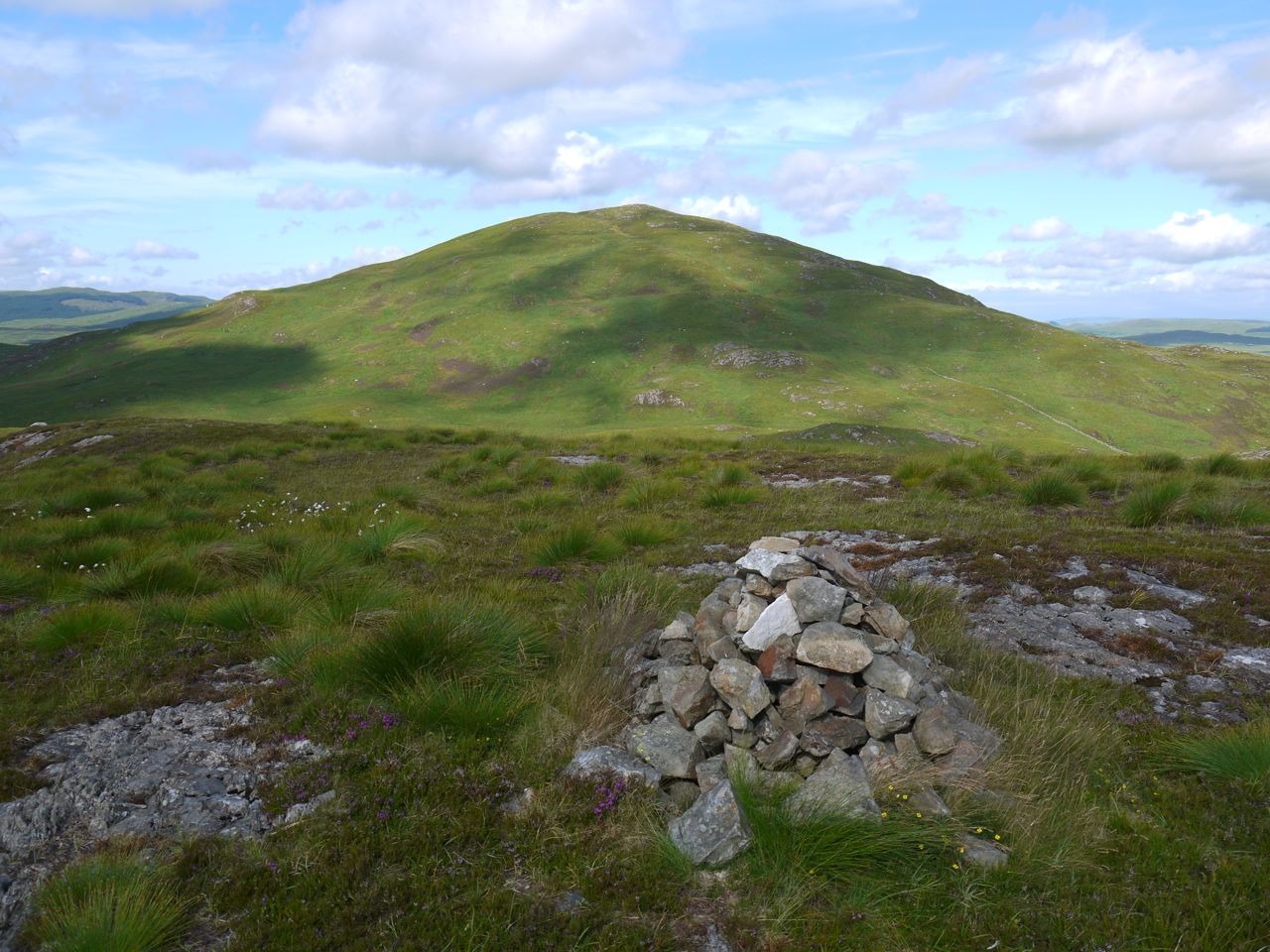
Western slopes of Craiglee, not grey
Once in the Nick I found that its even green surface was hiding the true tussocky nature of the grass but it was relatively dry. There was no path up Craiglee and I tended to chose a feature and head for it. If heading towards an erratic I would sometimes find a brief track suggesting that other walkers had being doing the same. I did get a little annoyed each time I climbed onto a small knoll that I might instead have climbed around, but eventually the craig I climbed was the the true top.
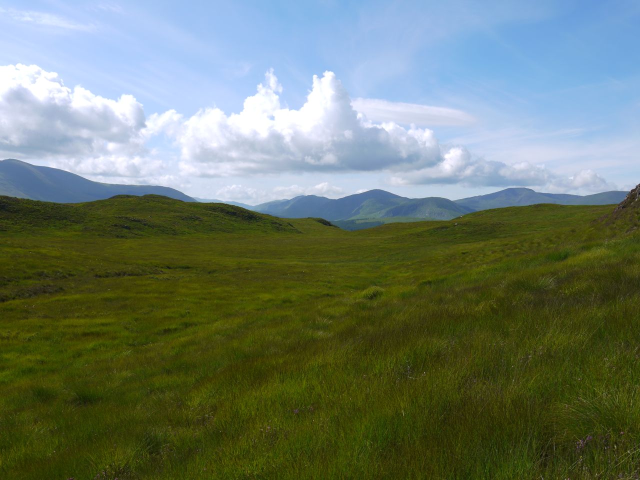
Nick of the Mahm
Craiglee has a top about half a kilometre long with a cairn at the eastern end, a trig pillar at the summit and a mini-cairn at the west. From Craiglee, Loch Finlas, the Loch of the white stream (fionn glas), lay in the valley like a flattened snake and Ailsa Craig was visible on the horizon beyond Loch Bradan. To the south the hills stretched from the Rhinns of Kells to the Dungeon Hills and the Awful Hand. To a casual observer Carlin’s Cairn would have seemed the Kells highest point but Merrick left no doubt that it was the chief knuckle of the Awful Hand. It was still too early for lunch so I put my camera’s memory card through its paces and then set off for the wee cairn at the western end of the Craiglee summit.
View south from Craiglee
Craiglee
Loch Finlas
I was tempted to cool my feet in the lochan but the surrounding ground had a high water content so I sat down on a small erratic to work out how I would get back but couldn’t make my mind up. I decided to head onto the southern slopes so I could see the options a little better. Having surveyed the land I headed in the direction of the Castle Island in Loch Doon, contouring with descent across the slopes of Craiglee. This proved easy enough. I tried to contour but allowed myself to drift down the slope. There were a couple of steeper sections but nothing troubling. This line brought me to the Nick of the Mahm opposite Mulluss.
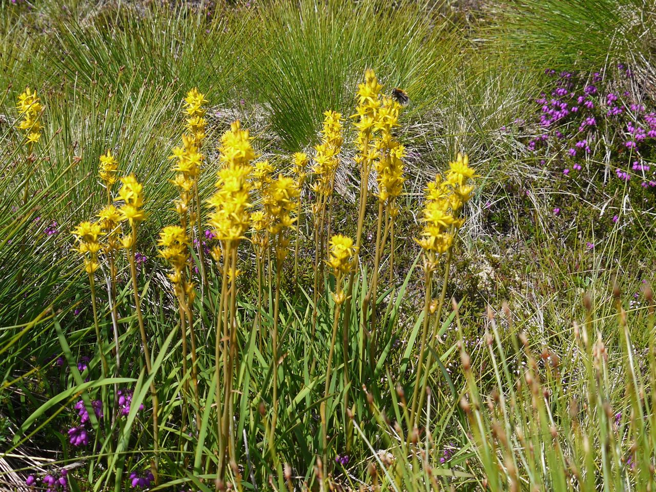
Bog Asphodel, Craiglee
Should I go around it to the north or the south? Or over it? The top it was. The Nick here was relatively narrow, and did have a narrow burn. The grass was deep tussocks but dry. As I mentioned earlier Mulluss is a pile of craggy Knolls piled together, its highest knoll has a small cairn and there are poles atop a couple of the others. One of the lower knolls did have a seat sized erratic that served me well for lunch.
From Mulluss I headed down to a break in the tree line. The grass of the forest break was lush, wet and waist high in tussocks. How this grass managed to stay wet when everywhere else was dry, I don’t know. I had begun to regret choosing this route as I stumbled along with grass ensnaring my feet but then I spotted a small wooden footbridge just a few metres further down. The bridge was on the Craiglea Trail.
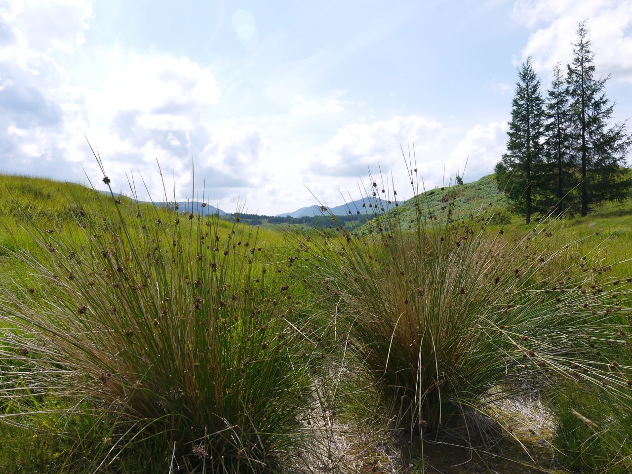
Rushes on the Craiglea Trail
Rather than head back along the trail the way I had come I continued along the trail which passed through woods and then moorland along to Carrick Lane. The trail path was well maintained and where it might have been boggy a proper path had been constructed. The views from the trail were very good and there was an excellent viewing point with a seat at the end.
From Carrick Lane I returned to Loch Doon Castle by the lochside road, intending to have refreshments at the cafe near Craigmalloch, but unfortunately it had closed down, so I made do with a drink of water by the car instead.
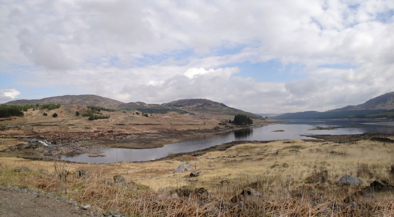
Craiglee, Mulluss and Wee Hill of Craigmullach from across Loch Doon in April last year
And the heavy rain in the forecast? That came when after I arrived home.
PS the hill in the picture at the top of the post is Mullwharchar, seen from the Craiglea Trail, with a bit of telephoto.
[osmap gpx=”http://www.screel.co.uk/walks/wp-content/uploads/2013/07/RK_gpx-_2013-07-27_0939.gpx”]
