10.2 miles 6h 8min ascent 775m

Am Beannan-Meall Clachach-Uamh Bheag-Beinn Odhar-Beinn nan Eun
The Glen Artney Donalds. What? If Percy Donald didn’t include them, why should I accept them as Donalds. Mind you, we shouldn’t blame the hills themselves. It is not as though they have been arguing for their inclusion in the list. Clearly Mr Donald didn’t feel they were in the Scottish Lowland Uplands, but others have decided that the Highland Fault should be the boundary. Since my own geological training is at the I-spy book level I can’t argue on that point.
So as self-appointed arbiter on the matter, I thought of this as an aesthetic rather than geological choice. Much akin to regarding a tomato as a vegetable. Did these hills feel Highlands or Uplands? I stopped every now and then and asked myself which it felt like. I had presumed it would be an obvious distinction, but despite a prejudice towards agreeing with Percy Donald, it wasn’t as easy as I had thought.

Ruchill Water from the road
Well, back to the walk. After negotiating water filled potholes in the road, and some reversing back to passing places (perhaps I need to be more assertive?), I parked in the Glen Artney Church car park. This even has a rubbish bin to spare me transporting my banana skins all the way back to the lowlands.
I had wondered if it would be better to walk over Auchnashelloch Hill or take the road. My choice was the road to the bridge over Ruchill Water. The reasoning was that it would avoid an unnecessary climb and allow me to warm up on firm ground. I was somewhat annoyed therefore to find myself walking uphill yet significantly above Ruchill Water from which I inferred that I would soon be descending. I don’t like heading down only to climb up again. (That sentence had to be reworded to avoid unintended innuendo).

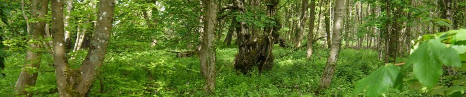
Track along Ruchill Water
At the bridge over Ruchill Water I had my first view of Am Beannan which helped me since I find walking is easier when I can see my target. There was a faint track over boggy ground along the east bank of the burn but it became more distinct further on. There are two steeper sections of bank and at the first the track was easy to follow though as it passed through some trees their branches caught my rucksack at times. I’m surprised that the track seemed so defined here, suggesting regular use, yet the tree branches encroached so much. Perhaps it’s used by animals. At the second steep section of bank, I could not see a defined track and the ground was covered in light snow making the grass slippery so I headed up 30m of bank to reach the flatter section above. This must be the beaten track since I soon picked up another track leading directly to the bridge over Allt Ollach at 280m. The photo at the top is the view heading for the bridge with Am Beannan in the distance.

Allt Ollach from the bridge at 280m
I’m pleased the bridge was here since I wouldn’t have fancied my chances on the moss and snow covered rocks of the burn. Looking at my map I had a moment of realisation, Allt Ollach rather than Ollach Burn. Linguistically I was in the highlands.
The plan from here was to head for the sheepfold at 310m and once there decide whether to head directly up Am Beannan or walk up to the Coire na Fionnarachd. The sheepfold was not visible from the bridge, hidden beyond a slight rise and the faint track leading from the bridge disappeared as the ground became boggier. Presumably people take a variety of lines across this wet area so no track forms.
The line up Am Beannan did not look as steep close up and its rocky terrain was more inviting than a boggy trudge up to the corrie. There is a prominent shoulder on the climb up Am Beannan and I headed directly up to this, with a little zig-zagging. Some sections were steep enough to allow hands to be used but overall I surprised how easy the climb proved to be given the slippery terrain.
On the shoulder I stopped for a breather and got the only glimpse I would have all day of Ben Vorlich. Then as I enjoyed a cup of coffee the first snow began to fall. By the time I reached the top of Am Beannan the hills to the north were becoming lost in cloud but Uamh Bheag and Beinn Odhar were still crystal clear. The stroll up to Meall Clachach was uneventful. The snow covered heather was relatively short and the peat hags either small or easily crossed. A fox must have come the same way along the ridge and I found it reassuring that we were taking a similar line. At one point the faint track disappeared and after walking across heather for a while I came back onto the snow to find the fox’s prints there as well.

Looking back to Am Beannan
The col below Meall Clachach had taller peat hags and it was much easier to walk in the snow-filled peat gullies where the snow was firm enough to support my weight. I soon learned that the snow would collapse where it lay on heather such as at the edge of the gully.
At the boulder 100m from Meall Clachach’s summit I was able to set the camera for a delayed timer shot but this was the last time that would be possible. From the Meall Clachaich summit I headed directly down to rejoin the fence halfway to the col, then followed the fence up Uamh Bheg. Within 20 minutes the area switched from clear in light snow to blizzard mode.
There was now way to set up the camera, so I was reduced to a hand-held self portrait with the wooden head, which turned out better than I had hoped given the buffeting from the wind.

Me with the Uamh Bheag head
My option to include Uamh Mhor was ditched and I headed along past the trig point and down towards the col. The visibility was now only a few metres but I had the fence as a guide. There was a steep craggy section which in the snow required a small detour. This left me on some snow sloping steeply down to the fence. Kicking steps in the snow didn’t work since the snow gave way to waist height, so I made my way over heather back to the fence. There was a stone man above this section and I suspect it marks a way which avoids this dip.

Stone man, slopes of Uamh Bheag
I find it interesting that the camera seems to have captured more than I could see. Further along the fence, the first wind turbine came into view, grey against a background of grey. As I stood looking at it, another became visible and then four more. I don’t think the visibility changed, so presumably my brain was gradually resolving these from my perception over a few seconds.

Beinn Odhar’s turbines from the better visibility of the col
There was smaller stone man (a stone dwarf?) above another small drop to the col. Below me a group of deer were making their way over the fence, the last small one seemingly unable to get across though after several attempts it found a way through the fence.

Deer below Uamh Bheag
In the photo above you can see the fence heading up Beinn Odhar. What isn’t visible is the deep gully cut by the headwater of the Garvald Burn. This burn was narrow enough to step over but the banks were steep and snow covered requiring a brief derriere slide.
The fence continues up Beinn Odhar to just above the highest wind turbine at 560m. The going along the fence was tough so I used the snow filled peat gullies where I could. Whereas a fox had walked before me on Am Beannan, a bird had done the same here. The prints were large and I had presumed it would be grouse or pheasant, but the four clawed print (NW, N, NE, S) is not a game bird according to my books at home.
Above the highest wind turbine the gradient eased considerably but the blizzard set in again. I was trying to follow a bearing with my snow covered compass but my glasses, though providing protection from the wind, were now hindering rather than enhancing vision. In the lee of a peat gully I had some more coffee and carbohydrate, and dug the snow kit out of my bag, swapping spectacles for goggles.

Blizzard kit
The peat gullies in this section were like a maze, and following a bearing was difficult, but taking a direct line in the heather, and climbing over gullies would have been very tiring for a grade 1 lazybones such as me. After wandering about atop Ben Odhar I chose a bearing for Ben nan Eun and headed off into the snow-filled mist. The easiest walking was in the peat gullies which weaved about and gradually seduced me off my chosen bearing and a little north of the col. It had been quite difficult to assess the gradient visually in the mist and snow but when it became steeper my non-visual senses were alert to the change, as I accelerated. At least the terrain here made it easy enough to contour around back to the col, then up to Beinn nan Eun. I wasn’t convinced the cairn/stick was the top so wandered about a little before returning to the cairn.
My way off would have been easy in good visibility, but now needed a little more care. I planned to head almost directly north for 400m, then turn in a direction to take me down the wide ridge between Allt Mor and Allt na Stainge. Winding peat gullies plus step counting plus on the fly corrections for that winding led me to overestimate the distance I covered, and turn 100m too soon. This error became obvious as I found an increasingly steep slope to my left, but was easily corrected by contouring until I was back on the ridge.
By now the wind and snow were easing off so I took off the googles to find that everything had become disconcertingly bright and blue. Thankfully by the time my glasses were back in place the brightness and dyschromopsia had resolved. A little further down, now in heather and tussock rather than peat hags, I emerged from the clouds to find a featureless valley spread beneath me. It looked as though a manufacturer of valleys had put the basic contours in place, coloured it all in shades of brown but had yet to add basic features like streams. I had hoped I would be able to see enough to identify a target but that would need more descent.
My plan had been to head for the junction of Findhuglen Water and Allt Mor, and the grouse butts marked on the OS map in the hope that I could pick up a path near them.

Descending to Finghuglen
While still in the mist I had found myself walking on a vehicle track, which gradually became more defined. Once out of the mist this track turned NE and I decided to stay with it rather than striking out across the moorland. In soon became clear that it was leading to Findhuglen. The valley floor there was very boggy, but squelchy rather than deep.
I had initially decided to head for the stream junctions downstream because I was sure there were bridges there, but I’m pleased to report that Finduglen is well stocked with bridges. The photo below is taken from one of those bridges and as you can see, Beinn nan Eun was already emerging from the clouds by the time I had got there. The rain (as it now was) had eased considerably but that was just a temporary lull and just a few minutes later when I considered taking a photo of the railway carriage amid the buildings at Findhuglen it was raining heavily enough that the camera remained stowed.

Beinn nan Eun above Findhuglen Water
As much as I like walking on hills it was good to have a firm farm track back to the car park. I was able to have a look at the burn junction I was originally aiming for and could see no sign of paths coming down to it, though the bridge and nearby grouse butts must have a path of sorts between them.
This walk was mostly in snow and mist but it wasn’t especially cold. The winds were strong enough to prevent me setting the camera on fence posts but not enough to interfere with walking. It’s a shame that I missed the views but there is something enjoyable about walking in the mist.
So should these hills be included in the Donalds? I don’t think so. I “feel” these are foothills of the highlands but exhibiting some southern upland features. So, I think these are not Scottish Lowland Upland Hills, but to be honest the case is “Not Proven”. Does it matter? Not really. Are they worthy of climbing? Yes, without a doubt.
.
[osmap gpx=”http://www.screel.co.uk/walks/wp-content/uploads/2013/03/RK_gpx-_2013-03-16_0909.gpx”]
