 10.42 miles 5h 48min 780m ascent
Bail Hill (Arch)-Green Hill-Mullwhanny-Colt Hill (Arch)-Benbrack (Arch)-Conrick (Arch)
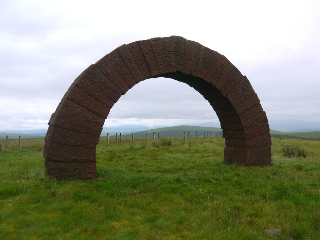
My challenge was to walk through each of the four Sandstone arches at Cairnhead, north of Moniaive on the same day. The Striding Arches were designed by Andy Goldsworthy in 2002. Each arch of hand-dressed red sandstone is four metres high, with a span of seven metres. Three arches are on the summits of Benbrack, Bail Hill and Colt Hill and there is also an arch at Conrick.
I parked close to a stand of trees at an old quarry opposite Glenjaan Linn. There is a sign to some nearby picnic tables. The OS map shows a path heading directly up a forest break to Bail Hill, but a brief glance up the forest break didn’t show any signs of a path and the way up looked quite steep. I am always wary of forest breaks and decided it might be easier to head up the unforested Dalwhat Hill instead.
This was an unpleasant climb. The day was humid. The lower slopes were covered in chest-high fern interspersed with gorse bushes. The ground beneath this flora was strewn with large rocks, steep and uneven. And the flies, oh my, they were out in droves and supported by midges. Whenever I paused for a breather the flies seemed to increase their numbers and move in for the kill.
Just above 300m there is a drystone dyke separating the fern-covered lower rocky section from the boggy and cragged upper slopes. A faint track headed off SE and I followed it while it climbed, then left it to zig-zag up the hill between the rocky outcrops picking my way through waterlogged sphagnum moss and areas of standing water. I was heading for the upper tree line but there were numerous false hopes where I thought I was there only to find there were in fact more trees.
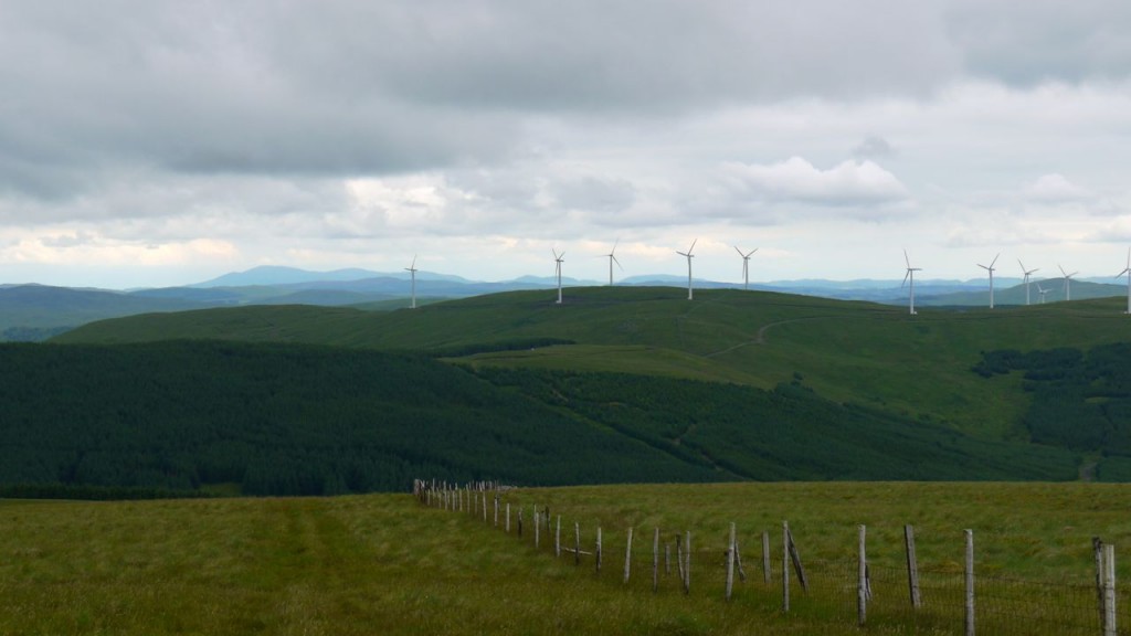
Eventually I reached the corner of the trees at the top of Dalwhat Hill. Having reached this point I expected to be able to look up to the Arch on Bail Hill, but though the hill was there a quarter of a mile away, I saw no sign of the Striding Arch. The views to the east did open out however and I could see Lowther with its radar station, Queensberry and the Solway Firth.
My next choice was which side of the fence to walk. I chose the forest side which looked greener, and it rewarded me with more practice picking my way around boggy areas. It also seemed to be magnetic. Why else would there be so much rusting fencing material there? The Bail Hill arch only came into sight when I was within a few metres of it. Naismith would have had me at the first arch in 55 minutes, but I walked through it after an hour and 25 minutes. My energy stores had been deeply tapped but I was relieved to be on the hill tops.
From the summit of Bail Hill, the Arches on Benbrack and Colt Hill could be seen clearly and gave me some idea of the walk to come. I had intended to pause at Bail Hill for a snack but as soon as I stopped moving the flies attacked forcing me to grab my bag and eat as I walked. The day’s weather changed here to light drizzle, heavy enough that the camera had to be stowed, sometimes heavy enough for a jacket, sometimes not. Unfortunately there was to be much donning and doffing of the jacket as I tried to get the right balance between dampness from the rain or from perspiration.
The walk from the Bail Hill arch to that on Colt Hill follows a fence so navigation wasn’t a problem. The terrain was wet, with waterlogged sphagnum moss deep enough to swallow boots, black peat bogs and small lochans. There were some faint quad bike tracks but these tended to be much more waterlogged than the surrounding ground and were best avoided.
Between Transparra and Mullwhanny there is a dip through a wide forest break. This was even boggier than the hill tops and the way was further barred by two water filled ditches that were too wide to jump. I managed to use the fence to edge across these. By the top of Mulwhanny I was running on empty and the flies had been drizzled away. I sat down on a fallen section of wall, and as I ate my lunch I felt my energy return.
I certainly needed that energy because between Mullwhanny and Blackcraig Hill there is a steepish 100m descent and re-ascent. This would once have been in a narrow forest break but the eastern section has been felled recently. Unfortunately several trees now lay across the easier, albeit boggy, ground forcing me to make my way across the felled forest terrain for a while.
I walked through the Colt Hill arch 3 hours and ten minutes after starting, half an hour behind schedule. I had been considering calling it a day and heading back down the forestry track, but the Benbrack Arch, less than two miles away as the crow flies, was too tempting.
I tramped my way down Colt Hill and up onto Black Hill to join the Southern Upland Way at a sign “Benbrack Arch 2”. I secretly hoped it was in km though I knew in my heart it was miles. This section of the SUW was boggy, which wasn’t surprising. I’ve walked this section in time of drought and it was boggy then. This section has good views of the Carsphairn Hills and the Rhinns of Kells.
I walked through the Benbrack arch at 4 hours 15 minutes.
As I walked up Benbrack I mused as to the best way off. The most certain was to retrace my steps back to the forestry track in the col between Colt Hill and Black Hill and follow that back to the car (over five miles and some re-ascent). My original plan was to walk down to Little Dibbin Hill and follow the forest break down to a path next to Dibbin Lane (on the OS map). There are however several forestry roads not marked on the OS and as I walked across the opposite side of the valley I was looking for a route down to one of those. There did look to be a forest break at the top of Back Burn and that seemed to join the forestry track.
So I headed off Benbrack along the fence heading SE and when it joined another fence at 530m I turned left and headed into a forest break. This was steep, slippery and petered out after about 50m. I then had a choice of continuing on through the dense forest in the hope of finding a break in the trees or climbing back out and going back to my original plan.
Forests worry me. Navigation is very difficult. The denser sections can be impassable. But perhaps more worrying, since I was solo, the chances of being found, if injured, when not on a track are slim. So I turned about and climbed back out of the trees. I subsequently looked on Google Earth and with hindsight I should have carried on. Perhaps more importantly I should have marked the forest breaks and new paths on my map rather than just remembering them.
So I headed down to Little Dibbin Hill, which is really several small wet hummocks amidst very wet boggy grassland, with a tiny lochan. I entered the forest at a break in the easternmost corner.
This proved to be well lit and easy to follow. There were some fallen trees to get round but the main problem was the combination of steepness and slippery soft surface. I stopped at one point to check my direction with a compass and found I was still sliding downhill. I looked for human footprints but saw only the deep prints of deer. Whenever the gradient eased the ground became very muddy indeed and it was difficult to stay upright.
At 425m the forest break branches. The left fork heads slightly uphill so I ignored it. I should have taken it since it would have led me to the Back Burn and the forestry track. As it was I continued on down and soon after hearing the waters of Dibbin Lane I came out of the forest into waterlogged grassland with waist high grass. As I waded through this jungle I noticed a flat section above me immediately next to the forest and climbed back up to it. This was indeed the track marked on the OS map, but I doubt it has seen human traffic for a long time. Being on a track gave me a false sense of security and my left leg’s plunge into a grass-covered knee deep puddle came as quite a shock.
The track passes briefly into the forest during which time it is firm and well defined. Perhaps it is maintained by forest magic and deteriorates when it leaves the cover of the trees. The track ends at Dalwhat Water.
I had hoped that there would be some way to get across in a degree of dryness, but there had been recent heavy rainfall, so I was disappointed. I was growing tired and couldn’t face tramping through the deep grass and bog of the banks to look for a better crossing and one leg was very wet already. The river looks as though it might be easy enough to cross in drier conditions just not this day. I found a section which had a shallow section in the middle, which I’ll bet is usually a small island, jumped to it then waded the rest of the way, climbing from the water wet from the knees down.
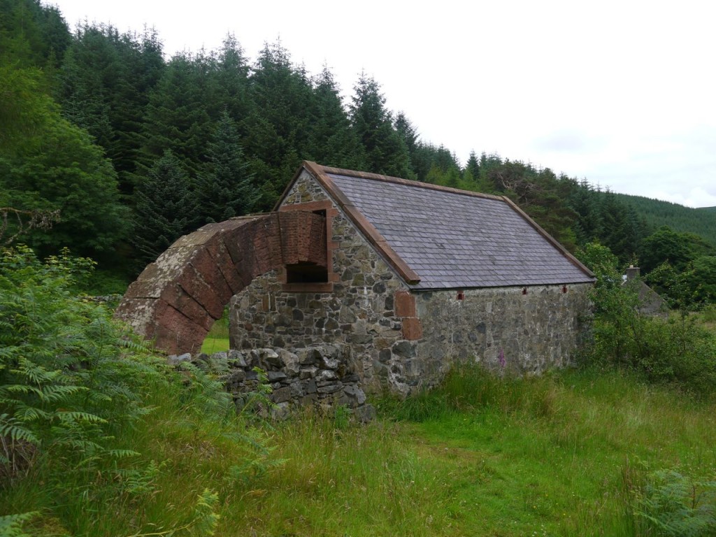
My newly wet feet made the remaining quarter of a mile across the water meadow less of a challenge since I had already kissed dryness goodbye. I eventually emerged onto the road near the sign for Byre Arch and trudged up to the final arch walking through it 5 hours and 20 minutes after leaving the car. I drank the last of my water and was rejoined by the flies.
There was then a further 1.7 miles along the road to get back to the car. I felt too tired to change into dry socks but made good time with a sub 15 minute mile, presumably driven by the elation of a challenge completed and the joy of a firm dry surface to walk on.
My advice: Choose a dry week. It is probably a good idea to climb the steep forest break to Bail Hill which is about a quarter of a mile past the stand of trees with the quarry, (half a mile beyond the cattle grid). I can’t say what the Bail Hill forest break is like, but it can’t be as bad as the way I went. When coming off Benbrack try to get to the forestry road which crosses Back Burn at 340m. This will allow you to cross the stream by bridge. The forest break I took was easy to follow, but be sure to take the left fork at 425m.


