11.8 miles 5h 28 mins 933m ascent

Clints of Dromore
Cullendoch-Door of Cairnsmore-Knee of Cairnsmore-Cairnsmore of Fleet-Meikle Mulltaggart-Craigronald-Loch Garroch
Cairnsmore of Fleet’s Donald tops, the Knee of Cairnsmore and Meikle Mulltaggart were my main targets for the day. They could be had via the tourist route from Palnure but that would include a there-and-back to Mulltaggart, so I decided to head in from Dromore. The next question was: clockwise or anticlockwise? I’d read reports of anti-clockwise but decided to go clockwise since I thought this would leave the easier sections for the end, when I would be tired. Good reasoning but a false premise. With the benefit of hindsight I would now recommend taking this anticlockwise.
I missed the turning out of Gatehouse of Fleet, as I had last time, since the sign only seems visible from one direction. It looked as if this would be a good day and as I drove towards Dromore, the Clints were bathed in sunlight and Cairnsmore of Fleet could be seen peeking beyond them. I drove past the visitor centre at Dromore then headed to park a little way past the viaduct.

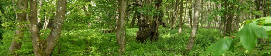
Door of Cairnmore from the end of the forest track
I did this walk in non-stealth mode, coughing loudly throughout. The first couple of miles were along forestry tracks with a gentle climb heading past a number of small quarries, parallel to and about half a mile north of the Clints of Dromore. After about a mile there was a large area of newly harvested forest, the wood stacks adding a fresh pine smell to the air. This opening gave me my first view of the complete Cairnsmore ridge from the Knee to Craigronald.
The forestry track ended with some rather impressively high gates, which are presumably to deter deer, and a National Nature Reserve sign. From here it was perhaps half a mile to the lower slopes of the hill at the Door of Cairnsmore. The flat section was grassland which was mostly dry and easy going but looked as if it has the capacity to be wet at times.
The Cardoun Burn was just too wide to jump but there where plenty of rocks to cross even if it were much fuller. Once on the steeper slopes the ground was firmer but the gradient was a bit of a slog psychologically. A recurring feature of this walk was that the summits couldn’t be seen while climbing, making it hard to assess progress. I found myself heading for features on the horizon which I thought were the tops of ridges only to find when I reached them that they were just another rock on the slope. I had to gauge progress up the slopes by looking across to distant hills and cols.
I met my first goats of the day on these slopes. Once on the flatter section of the Knee of Cairnsmore the summit cairn was close by. A welcome place to sit for a rest. Visibility was very good, as predicted by the weather forecasters, with the Isle of Man clear on the southern horizon.
Once on the flatter tops of the whaleback hills the going was much easier. There was a faint track heading up towards Cairnsmore of Fleet but this often faded away, especially in the wetter sections such as the Nick of Clashneach, where there are several lochans.

Cairnsmore of Fleet Summit
Cairnsmore of Fleet’s summit is a wide flat expanse with several features: a large cairn; a trig pillar; a shelter; and a memorial to airmen killed on the hill.
The last time I was here there was ankle deep snow and very limited visibility, so I was impressed by the views which included the Minnigaff hills nearby, the Galloway hills behind them and the Rhinns of Kells.

Memorial to Airmen killed on Cairnsmore of Fleet
The memorial to lost airmen lists the names of 25 British, American, Canadian, New Zealand and German airmen killed when their various aircraft crashed on this hill. Details of the crashes and names of those killed or injured can be found at Air Crash Sites in Scotland and make sad reading, all those killed being so young.

Troll’s Head
Since Meikle Mulltaggart isn’t visible from the summit plateau I headed off a little south of NE and once the hill was visible corrected my route. In bad weather a line of fence posts could be followed but these are a quarter of a mile from the summit. On the way up Meikle Mulltaggart I passed a boulder that looks like troll’s head.
So far so good. But all good things must come to an end. Craigronald was the end of the good things. The ground became waterlogged, tussock strewn and littered with rocks and hidden holes. This made the going tough but in addition, Craigronald looks as though some ancient giant has taken his hammer and smashed the hill into a concertina of rocky ridges. I decided to start a gradual descent of the hill along its southern flank rather than climb over these ridges. The final section was quite a steep descent in places but the section between the hill and the forest track was a nightmare.

First glimpse of Loch Garroch
The ground here was tussocks and waterlogged mush, leading to at least one fall, and somewhere along here I lost the lens cap from my camera. The going was so hard, and I was so tired, that I couldn’t face retracing my steps to look for the lost lens cap. Hopefully, being non-biodegradable, it will make a future archeologist happy.
Here I made an error. I confess so that others may be spared. I had read, in the anti-clockwise report, that the way up Craigronald was to head from the lodge through the trees onto the hill. So I headed for the trees where I thought I could see the lodge. There is a wall. Before the wall the ground was very wet, uneven and unstable. Over the wall it was much, much worse. The first trees all looked dead, perhaps they had drowned? A little further in is an impenetrable wall of bushes and trees. I was forced to climb back out of the walled hell and make directly for the track at the head of Loch Garroch. Perhaps it is easier to find a way going in the opposite direction.

Zombie trees at Loch Garroch
Back on the forest track from Loch Garroch I had wet feet but couldn’t be bothered changing my socks. The light had changed leaving the loch un-photogenic, and I had lost my sense of humour. The track climbed away from the loch past a small memorial to Maggie, who I believe was a pony, then through the Clough of Eglon. Even in my unhappy state it looked pretty. There were a great many bright yellow dandelions on the path and if I had been in a better mood I would have taken the time to photograph them.
Instead I remembered the sign I had seen at the beginning of the walk, “Loch Garroch 2.5 miles”. I strode out, but this 2.5 miles took much longer than I had thought it would, just under an hour. Leading me to stop a couple of times to check I was going the right way. The sign was, at the least, economical with the truth. The distance as the crow flies is 2.5 miles, but the track was 3.5 miles.
")
Memorial to Maggie (pony)
At Meikle Cullendoch, the ruins have been incorporated into a garden, which produces an impressive rockery. Further along at Little Cullendoch the ruins are worth a visit since they hide a small sculpted face.
As I walked the last couple of hundred metres, the Big Water of Fleet viaduct came into sight, lifting my spirits, but my car didn’t seem to be there. Surely it hadn’t been stolen from here? Had I broken some terrible forestry by-law (parked on a wildflower, blocked a natterjack toad crossing) and had it towed away? Would my mobile work out here to summon help? 100 meters of worry, then relief. The car was hidden behind a small bank of earth.
I don’t think I’ll be taking this route again. The mile or so from Craigronald to Loch Garroch, and especially the section from the bottom of the hill to Loch Garroch, spoiled the enjoyment. It would perhaps be better done anticlockwise. It might be easier to find a way up Craigronald in that direction and the climb would be done while still sprightly. There would also be the option of returning over the Clints of Dromore if energy levels and sense of humour permitted.
.
