Loch Doon-Coran of Portmark-Bow-Knockower-Black Craig-Loch Doon
The primary aim of this walk was to climb Coran of Portmark, since previous visits to the Rhinns of Kells had come off over Cairnsgarroch, leaving Bow, the Coran and Black Craig unclimbed.
The most described route would head in past Garryhorn, take all these hills in a sweep and return over Cairnsgarroch. So why didn’t I go that way? The descent of Cairnsgarroch, or more specifically the terrain, a couple of years ago had left a lasting impression with me, and not a pleasant one. The whole area is covered with angry Dougals nestling in a hidden concoction of bog, rocks and holes, the kind of terrain that would in ages past have halted an advancing army. So I wouldn’t be going that way.
I could of course avoid Cairnsgarroch’s slopes by doing a 180 on Bow and retracing my steps. For some reason I disliked the shape of such a walk. Not rounded enough. Aesthetically unpleasing.
I looked at walking in from Drumjohn or Lamach but dismissed these for the same reasons.
Then I turned my mind to approaches from Loch Doon. Forest bars a direct assault from Loch Head to the Rhinns but there is a single dotted line on the OS map along the Loch to the slopes of the col between Black Craig and Coran of Portmark. A path? An old right of way? There is also double dotted line through the forest parallel to this about 300 metres in the forest but it stops just over a kilometre short. Would it actually continue, or would it lead me into impenetrable forest?
While musing on the options I noticed Portmark on the shore of Loch Doon. Ruined buildings. It would be nice to see them wouldn’t it? This thought was like a barbed arrow. I couldn’t shake it off. Whichever way I went, this would have to be included.
Then a second barbed arrow. I found a description of this part of the route in which the writer described the terrain here as the worst he had ever experienced in Scotland. Having tramped through tussock infested bogs and slipped in my fair share of mud, I was intrigued. More research suggested said author was well walked, and not one to moan over trifles. It couldn’t be that bad, surely? Another definite place for the walk.
This would still leave me with a route exhibiting too high a circumference:area ratio. Not round enough. I turned my mind back to a traverse of the forest from Loch Head to the foot of either Meaul or Bow. There were several forest breaks on the OS and these were discernible on Google earth’s 2010 imagery.
Forest breaks, in my limited experience, are not ideal paths. Better than quicksand or dense forest, I’ll admit, but all the same best kept to a minimum. I found the route that required the minimum distance on the breaks (just 0.75 km). It would need a final push through forest at the end, but only 100m I reckoned.
It is interesting to analyse the planning process since it offers me insights into the workings of my mind. I clearly have weaknesses. That’s the introduction over. Now on to reality.
The forecast was occasional heavy persistent showers and hail but the drive in was in glorious sunshine. I had hoped to be able to leave the car at Starr. Indeed secretly I was hoping to be able to drive all the way to Loch Head. Sadly the gated bridge over Carrick Lane was locked so I had a mile and half to walk to Loch Head. At Carrick Lane there were a number of tents, vans, dirt bikes and hardy looking chaps drinking (tea?) from battered mugs. I smiled benignly at them and offered a good natured “morning”. Well, what do you expect, I was setting out on walk, well fed, and the sun was shining. I gave the dirt bikes little thought. Arrrgh!
There was a slight climb up to the old cottage at Starr. The place looks abandoned but has obviously had a new driveway built recently so perhaps there are plans for it. From Starr to Gala Lane the road descends which I dislike since it means ascent on the way back. At this time the Rhinns of Kells were bathed in sunlight and the Loch’s waters still, reflecting the sky and hills. Paradise must be like this.
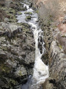
Gala Lane is relatively narrow where the bridge crosses it and has a pleasant small waterfall just by the bridge. This belies its power which has at times washed away bridges upstream of here. The road then turns up the eastern side of Loch Doon, past the sheepfold, one possible route into the forest and over a small bridge at Loch Head Burn, another possible route. I had decided to use the loch-side path for my return route, climbing back into the forest to find the forest track if the terrain was really that bad.
My way through the forest was to initially follow the Small Burn, which is the one after Loch Head Burn. The plan being to take the first forest break on the right ( about 100m), then the next on the left (another 100m). This would take me to a long straight forest break heading just south of east which would climb to the foot of the hills between Meaul and Bow. The option then would be to go directly through the forest which was only a short distance, 50 metres at most, or turn right along another break which was a longer route but likely to be easier.
The going was relatively easy initially over moss covered rocks later giving way to the expected tussocks and boggy ground. Sadly my planning was to be upset and I was not destined to walk as I had planned. The smaller forest breaks can be difficult to spot close up and, without realising, I had missed the first right turn but stuck with the “first right first left” plan and found myself as expected on a wide straight break along which I made excellent time. There seemed no reason to check a compass bearing and within the forest all the landmarks were hidden. Eventually I came to the T junction where I would either head straight through the trees or take a turn for a little more forest break.
I chose the direct route but the forest was impassible, the trees’ branches interlocking right down to knee level. I don’t think a machete could have managed it. An elephant perhaps, but I hadn’t brought one.
This then was a good time to stop, rest, have drink of water, some carbohydrate and chose an alternative path. The pre-decided way was to turn right but I wondered if left might be better. Not much to choose between them on the map but the right turn did get the whole way in forest breaks. Then the first moment of consternation. These forest breaks weren’t going in the right direction. Perhaps the compass wasn’t working properly. I should check it before setting off, but I rarely do. Perhaps I was stood near some compass-confusing metal object. A buried alien spacecraft, secret cache of spears and shields?
I dug out the phone (GPS enabled and tracking the route for posterity) from its waterproof bag in the rucksack and looked on stunned as it displayed my position. Nooooooooo! Suddenly it all fell into place. The forest break hadn’t been climbing as much as it should. In fact it had hardly climbed at all. Having missed my first correct turn, the forests breaks had with each turn led me further off course. The last half mile had been heading nearly north rather than east, hugging the contour and making no headway across the forest.
I couldn’t face backtracking to where I had gone astray and I had been gradually putting more forest between myself and the hill. If I turned left the break would lead me to the forest track in 250m and I would take it from there.
The forest track was in good repair and gave my legs some respite from the harder forest breaks. But all good things come to and end and so too did the track, but a good path led on from it. I could follow this to the edge of the forest then head up Coran of Portmark.
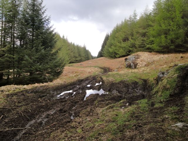
Now, do you remember those dirt bikes, caked in mud at the beginning of my walk. They were now forced back into my consciousness. One man’s enjoyable pastime can be another’s source of annoyance. There had obviously been some kind of dirt bike extravaganza here the previous day. Once off the metalled path the ground was well and truly churned up. I can only presume that the aim was to ensure no section was left passable for those with the temerity to proceed on foot. And the bikers obviously didn’t care how dirty they got ( private joke: a comment from my nephews when they were very young and watching a war/action film with soldiers covered in mud.)
Had I been in a film the music would have changed at this point to emphasise the change in mood. Nature has its own music. The sun went for a coffee break and a few spots of rain started to fall. Not enough to require waterproofs, but enough to place them on the list of options.
A little heavier. I should probably put a jacket on but won’t need trousers. It wouldn’t hurt to put the rucksack cover on though. Heavier still. I wish there was somewhere I could sit to put the waterproof trousers on, but at present I’m stood in a motorcycle induced mud bath. OMFG heavy. Leans against a tree and manages to get over-trousers on without falling over.
I then picked my way along the muddied forest break. There was a tumbled down wall but the bikes had used both sides of it. Here’s a learning point for the unwary. Just because mud has a tyre track in it doesn’t mean it can support your weight. Indeed my experience now suggests that your leg could sink to the upper calf in it. This was almost a full mud bath but there is a reflex in newborns (the Moro reflex) where they fling out their arms if their head moves back and this must have remained enabled in me allowing me to instinctively grab the nearby wall and fall onto it rather than the ground.
This ground needed crampons. Soon though I emerged from the forest and began the climb up Coran of Portmark. The bikes had been here too but the ground was better drained and only a few sections had been churned to mud. The going underfoot was much easier but the gradient worked me into sweat.
The rain turned to hailstones for a while then slowly stopped to allow the sun to begin baking me in my foul weather kit. But like a cat toying with a mouse, the weather toyed with me, throwing some rain at me whenever I took off my jacket.
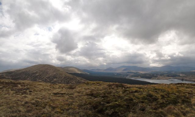
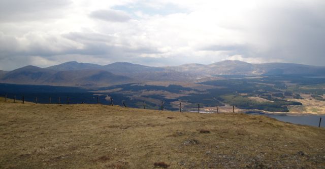
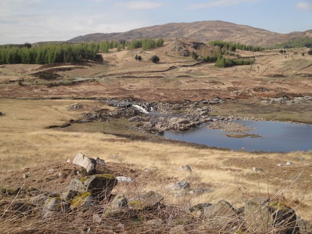
The walk then began to come into its own with beautiful views of Loch Doon and Loch Finlas beyond Craiglee, the Rhinns of Kells separated from the Dungeon hills by an apparent sea of trees, and beyond them the hills of the Awful Hand. Once onto the col the Carsphairn hills lay curled up like a dog in the sunshine. Heavy showers crossed these hills throughout the day sometimes leaving me dry, sometimes wet, but changing the appearance of the hills. I had hoped to capture something of the changing appearance but the old camera functions poorly in the low light of these wee storms.
I’m not sure which is my favourite view of the Galloway hills, that from the Rhinns of Kells or that from Lamachan. It’s a close call.
After the slog up Coran of Portmark I enjoyed the views and pondered how un-local my snack was. Certainly not something the Gallovidians of yore would have had (coffee, banana, corned beef and Pickle).
It was then a short jaunt over to Bow and a look down to the forest where I had hoped to have emerged. The slopes of Bow would certainly have been no problem.
Rather than climb the Coran again I decided to contour around it just above the steeper western slopes and head for Knockower. The climb up this wee hill, and down it to the shoulder between it and Black Craig was hard going. I was tired and the ground was wild with heather, moss and bog taking an extra toll on my energies. At least the rain seemed now to have passed. That I even visited Knockower must mean I have a hill-bagging gene.
On the map there is little to chose between Black Craig and Knockower in height but the former seems much more imposing, probably because it is a more defined (steeper) hill. Its ascent and descent are wild and tiring. The views from its summit however are worth the effort. Loch Doon can be seen in all it’s glory and the sight of the Rhinns and Dungeon hills from here is a joy.
I looked down on the small rocky outcropping of Craigencolon to the north and tried to decide if it should be regarded as the last part of the Rhinns of Kells. I had intended including it in this walk if I was ahead of time, but sadly I was not. Perhaps one day I will walk the whole of the Rhinns of Kells in one walk, Darrou to Craigencolon, then I’ll have something to boast about.
I headed off Black Craig towards the forest break I had emerged from earlier but the going was difficult. Not especially so but I decided to make it easier for myself by heading for the path up Coran which would involve less wild walking. This would require care in poor visibility as I found myself looking over a steep gap in which the Polmeadow burn runs. I had to follow this down a way to below the waterfall to cross the burn. Then I was back on the track about 250m from the tree line. From Black Craig I could see the forest break I wanted to take down to the shore (along the dotted line on the OS map). I’m pleased I did this since once there the break was not easy to see. It begins just about one or two trees along the path I had come along earlier but heading SW.
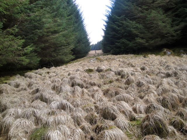
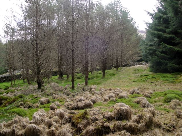
This was the usual tussocks, but interspersed with tussock free zones made of deceptively slippy moss covered slick. One section of Dougals had small bushes of bracken that appeared dead, perhaps due to the bogginess, but could have still been in winter mode since the light here was markedly limited by the trees. I remember thinking how unpleasant this would be to walk through if the bracken grew larger. In retrospect, this was a little like one of those horror films where whatever you think about (your worst nightmare) is spun into reality by an evil being.
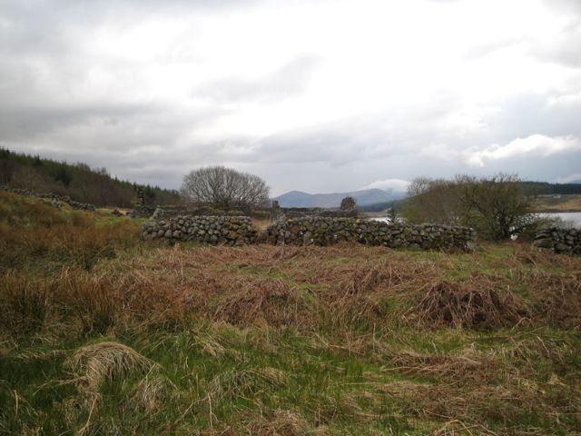
The path, if you can call it that, eventually passed a long lost sheiling which now encircles mature trees rather than livestock. My photo of this looks as though the Dougals are rushing out ahead of me. I wonder if they do that, run about until I come by and then freeze in place? Perhaps the forest sprites were driving me crazy.
Eventually I came to the edge of the woods and was able to experience the devil’s terrain: bog, rocks, mud, tall tussocks AND mature bracken. This is what Sauron must use to guard Mordor. And to the writer of that previous report, I concur, it is the worst terrain I have walked as well. (Addendum: how easy it is to forget, this isn’t actually the worst terrain. I’d forgotten Cairnsmore of Dee, all of the above plus recent tree felling.)
How you would ever find this forest break if coming the other way, I do not know. It is two burns beyond Portmark and just short of a large boulder on the shore.
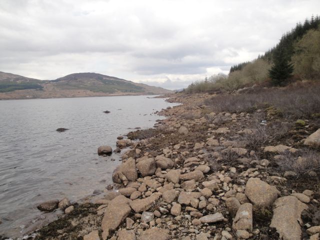
From the Sheiling to Loch Head took me just shy of an hour. There is no path or track to follow, the ground is hard going and boggy with plenty of bracken, sometimes quite large growths barring the way. Since the loch’s waters were relatively low I walked some of the way on the rocky shore. This wasn’t ideal but did give my ankles and balance a good workout. Sometimes the shore was quite squidgy and care was needed to avoid losing footwear in mud.
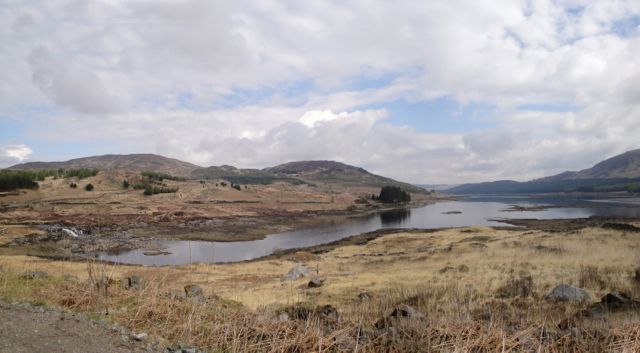
The lapping of the water was relaxing though and there were nice views of the loch and the distant hills. Every now and then I would glance up the shore and see what appeared to be a path. I would fight my way over rocks and through bracken only to find it was an illusion and almost always worse than where I had come from.
This went on and on. I had been walking a long time but seen no signs of Portmark. I presumed I had somehow missed it, but I was just making very slow progress. Eventually the ruins appeared. By now I really couldn’t be bothered climbing up the shore for better pictures and the light was poor. On the plus side there did seem to be a faint path but it didn’t last long.
Along here there were several concrete bridge structures over the burns. These were not useful to me since their approaches were often overgrown and they were mere skeletons, the widest sections being about 6 inches across. They look as if they may once have carried a railway. They look too modern to be contemporary with the lead mines and I can’t think why they would be there. There are no signs of tracks between them, but admittedly I wasn’t specifically looking for them.
Once back at Loch Head I was able to climb up onto a vehicle track lined with junior fir trees, the very small ones covered in small buds giving them the appearance of decorated Christmas trees. My penance was over and the remaining half hour was on good quality forest roads, retracing my steps past Starr to the car.
The sun decided to shine again during this section, defrosting my soul. The dirt bike guys and their equipment were all gone but they had obviously considered future archeologists and left a selection of rubbish behind. It’s surprising how much rubbish there was on the far shore of the loch, mostly carried by the water I presume.
Most hill walks mature in the mind. The hardships and misfortunes metamorphose into jolly japes and proud achievements. The joy of completing the challenge and the wonderful views become fixed in the memory and linked strongly with positive feelings. As I trudged along Loch Doon’s shore I reckoned it would take a year for those changes to occur in my memory, but it is only two days since and I find it is already filed under “happy memories”.
If you feel inclined to take a similar route, I would recommend taking more care than I in navigating the forest breaks, taking a brief rest ( and some jelly babies) before climbing Knockower, avoiding the single dotted line and taking the forest track back to Loch Head. If you are as daft as me and decide you have to see the hidden sheiling and the ruins at Portmark, then grit your teeth and take your time, but from Portmark take one of the forests breaks up to the forest track, it’s only 300m.
[osmap gpx=”http://www.screel.co.uk/walks/wp-content/uploads/2012/04/RK_gpx-_2012-04-22_1005.gpx”]

