Tarfessock-Kirriereoch
Kirriereoch and Tarfessock had been on my to-do list for a while. Unfortunately my research suggested there was no easy way up these two hills. The walk from Slaethornrig looked to be the shorter option but would include some unpleasant tussocky terrain. I had experience of this from my Shalloch walk and didn’t fancy it unless I toughened up a bit or needed some penance. The alternative was to climb from the west, but I had read that the approaches were tough, crossing areas of felled forest and required a burn crossing that seemed quite wide on the OS map.
Since the weather was good, both sunny and dry, I thought the time had come to grasp the nettle and climb these hills.
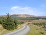
I headed for Kirriereoch Farm off the Straiton Road. My plan was to park by the picnic area or Kirriereoch Loch and walk from there. But the forestry track looked in good nick so I drove on. And on. And on. Over the Pillow Burn then right towards the trees. Here I found a group of mobile toilets. Perhaps they are for forest workers, or just stored here? There was plenty of space to park a car and still leave room for other vehicles to turn.
My plan had been to head along a forest break heading east and then strike out for the slopes of Tarfessock. But there looked to be another way, following a line of fence posts onto the hill. There even seemed to be a track, with footprints, leading that way.
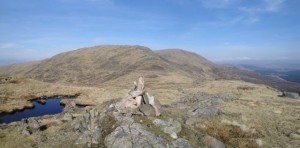
It was a good choice. The track continued up the slopes of Tarfessock all the way to the summit. The first 5 minutes or so is over what would have been muddy terrain, but this was mostly dried up. Once past the tree line the ground was dry. The track led up over a couple of false summits to the top of Tarfessock. A very pleasant walk with Shalloch-on-Minnoch and Kirriereoch to either side. Once on the summit, a rather flat rock strewn area, the views are extensive.
There are the buildings at Slaethornrig and Tunskeen, the alternate start to these hills. Beyond them the lochs Riecawr and Macaterick. The Dungeon Hills, Loch Enoch, Merrick, Mullwharchar, and the Rhinns of Kells made up the rest of the panorama.
From Tarfessock, a track leads off towards the lochan strewn ridge leading to Kirriereoch. This ridge tops the Carmaddie Brae below which the area has numerous boulders. The boulder covered area looks as though it would be a pleasant walk (over to Tunskeen), but I know better.
The ridge has several small lochans and is made of hillocks. The track often leads to the top of a bluff. So either many people have done as I have done, walked to the edge then turned back to find another way, or they have climbed down. Despite leaving the track many times, my route would soon rejoin it. The main problem during this section is the view of Kirriereoch which appears to have very steep sides. I had hoped that some obvious, less steep, route up would appear but it did not.
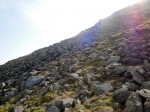
I decided that following the track was the best hope of finding the way up. The climb is up boulder slopes interspersed with grass. No obvious path existed so I just picked my way up trying to keep on the grass where I could and occasionally scrambling up rocky parts. While climbing a worryingly steep section I heard an aircraft. I was expecting a search and rescue helicopter but it did not sound right. Once I felt safe enough to turn round I saw it was a fixed wing job, but not a light aircraft, an RAF Hercules in the usual grey camouflage. The impressive part of this was that it crossed the col lower than me, then dropped even lower to cross the Doon forests. I would have been at about 700m-750m and was looking down on it.
Kirriereoch eventually flattened out. At first I thought I could see the top of a cottage on the summit. It seemed strange that such a large structure would be built up here and that I had not heard of it. It was in fact a shelter but my mind was playing tricks regarding size and distance perception. Similar problems occurred in finding the actual summit. The shelter was clearly not the highest point and I was not convinced that either of two cairns were either. I spent some time walking to what looked to be the summit then spying somewhere that looked higher. During this wandering I often had the experience of walking towards a place that looked higher but with my other senses telling me I was walking downwards. I presume this is something akin to the gravity hill illusion which occurs when the true horizon cannot be seen.
The way off Kirriereoch is as easy as following a dyke. The terrain is easy, on close cropped grass, and a track suggests many others have walked this way. After a mile the dyke is replaced with fence posts and after a further half mile the posts take a right turn. This is to avoid the very steep Torrs of Kirriereoch. A boulder, the Carnirock Stone marks the change in direction.
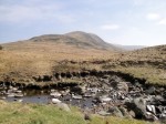
Unfortunately once below about 350m the ground is water logged grassland. My main concern was whether I would be able to get over the Cross Burn. I had planned for the worse (wading then walking the rest of the way wet) and brought a full change of clothes in the car. There were several possible crossing points leading to the forest fire break.
But. The track I was following continued on and would eventually join the fence line that I had started on, so I kept on it. The Cross Burn water was very low and it was actually easy to get across though the banks were pretty waterlogged and needed care. By this time I was only half a mile from the car and was spending my time thinking how much easier it had been than I had imagined.
A barbed wire topped fence was to my right and clearly I would need to cross it at some point. In one place it was sagging and it seemed a good place to get over. I placed a hand carefully on the wire and easily cocked my right leg over. Unfortunately the ground on the other side was boggy and my foot sank much lower than expected. My brain must have rapidly calculated that there was soon to be an intimate meeting of my wedding tackle and the barbed wire. Some reflex kicked in and threw my left leg up over the fence beginning a pirouette. This movement had both angular momentum (anticlockwise) and linear momentum ( sideways and downwards). Physics dictates conservation of momentum, so like a toppling spinning-top I continued rotating onto the waterlogged ground. It was only an inch or so of water once I was lying in it, but it’s amazing how quickly it can be absorbed into clothes. The camera somehow stayed dry. Surveying the damage, I had gouged both index fingers and wiped these with a handy-wipe. Antiseptic had to wait for the first aid kit at the car (ah the joy of stinging).
It was lucky I had brought the dry clothes really.
Particularly galling was the fact that the barbed fence fell apart about 50m further on and I could have just walked across it.
Overall this is a very good route. It would certainly be worth repeating but it is probably best to avoid it in wet weather. Had I headed back along the forest break as originally planned I would have crossed the burn at about 330m rather than 290m. This would have avoided the wetlands, but who knows what the forest break would be like? I’ll find out next time.


