Saddle Yoke-Hartfell Rig-Hart Fell-Falcon Craig-Swatte Fell-Nether Coomb Craig
The Moffat hills are whalebacks, which from a distance look like drumlins that have grown into giants. This walk shows another terrain, the steep sided crags of the Blackhope and Carrifrans glens.
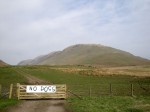
There is a parking spot large enough for a couple of cars near Blackshope cottage. If there was any question as to whether the walk was appropriate for dogs, some one had left a useful information sign addressing that very question.
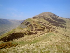
Looking up Blackhope glen the long ridge running up to Saddle Yoke looks impressive, something like an elongated ziggurat. The walk starts following a farm track but at a sheep fold it is best to head off the track and up the hill. There is a stile over the fence, always a good sign that some route passes that way. The initial climb is steep but not uncomfortably so. As I climbed there were several tracks some of which seemed to gradually climb, which is unusual for animal tracks. I followed a couple of these, wondering if they might be part of a long zig zag path up, but didn’t see any switchbacks in the path so eventually just climbed straight up.
The first 45 minutes are a bit of a slog up the rises of the ziggurat, one false summit after another, but then the view opens up. A narrow path leads up to Saddle Yoke which stands between the steep sides of Swatte Fell and Carrifran Gans, each sporting 400m drops. There was even a little snow left in the shade of Hartfell Craig.
Once above 400m the walk was much more enjoyable with the path, and summit, ahead easily visible. There was now even a little breeze to cool the hot sun, but I suspected that sunscreen or longer sleeves might have been in order. Luckily I had brought my sunhat.
Saddle Yoke is the smaller of the Saddle Peaks, Under Saddle Yoke being 10m higher despite the name. From a distance the summit looks like an old-fashioned saddle, but up close you wouldn’t guess it. There is a small cairn just below the summit of Saddle Yoke, and I rested my rucksack on it while having a well earned snack and stowing my first water bottle, now empty. I have given up using a water bladder since I never know how much I have left and have a tendency to take sips from habit rather than need.
The small col in the Saddle is about a 35m drop and 45m climb. The path is narrow but not dangerous. All the same I wouldn’t recommend this part of the walk in strong winds. In that case it might be safer to cross the col on the right of the path. If you were to fall that way, a fence below might prevent you going all the way down.
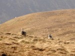
Once over Under Saddle Yoke I was surprised how much more ascent there was ahead of me, another 200m up HartFell Rig. I followed the fence down, and had intended following it until it met the fence heading up Hart Fell. Some mountain goats stopped their grazing to watch the strange creature in a sunhat wander past. A pair of hares also stood watching me but scarpered when I got the camera out. Once I was at Priest Crag I decided that following the fence up another 100m only to come back down was a waste of energy. I couldn’t see the fence on Hart Fell Rig at first, but spotted it from Priest Crag. I headed straight across to the fence.
This may have been a false economy in effort. The terrain would in normal circumstances have been a mixture of water meadow (higher up) and peat bog (lower down). Because we had had a few dry days it was merely waterlogged (sodden footwear grade) and needed some care to avoid the standing water (partially hidden by grass). For all I know, following the fence could be just as bad, but next time I’ll try sticking with the fence.
The 200m up Hartfell Rig and onto Hart Fell itself is on firm ground. It is about a mile and a half up to the summit of Hart Fell, but most of the climb is in the first half mile. The views to the south, looking down Blackhope glen are of the Ettrick hills, and to the north, Talla reservoir and its surrounding hills. The haze, unfortunately, meant the photos were poor. I had hoped that the haze might have added atmosphere to the photos, but it merely spoiled them.
The last time I was on Hart Fell, it was covered in snow and so cold that my face was numb. This time I was warm enough in a t-shirt and had sunburn. As I arrived at the trig point, another walker was leaving, heading west, the only other person I saw on the hills. The trig point’s shelter provided a welcome seat while I checked my route on the map.
There is a well trodden route heading southwest along with the fence. This heads into a col then up onto Falcon Craig. There were no birds of prey to be seen here but one was circling on the other side of the valley over Saddle Yoke. The path is close enough to the edge to give very good views of Saddle Yoke, Redgill Craigs, Saddle Craig and Whirly Gill.
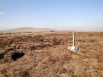
The next hill is Swatte Fell, one of those flat topped hills with no obvious summit. I had followed the track as it peeled away from the fence but soon realised that I was missing the summit. After some backtracking and wandering about I found a small cairn with a pole stuck in it. Unfortunately, this and another one like it seem to have been built by a practical joker since neither seem to be the actual summit.
The fence continues on over then down from Nether Coomb Craig, eventually crossing the Hang Burn. I had read that it was important to stay south of the burn so I climbed the fence and continued down the hill eventually joining a faint vehicle track leading to a gate.
From here the going was easy. A footpath leaves the vehicle track taking a slightly steeper route down than the vehicle track, though they merge again a little further down the hill. This section gives some views of Hanging Gill and the steep hill beside it. Getting down that would certainly be a challenge.
As I walked off the hill I had my only mishap, slipping in a pool of slurry. Luckily some slapstick moves with sliding and windmilling of the arms prevented me falling flat on my back. Strange how the mind works though. This event must have lasted only a second but I had time to wonder how I would drive home covered in excrement. I could have worn my waterproofs I suppose.
.
[osmap gpx=”http://www.screel.co.uk/walks/wp-content/uploads/2012/03/RK_gpx-_2012-03-25_1201.gpx”]


